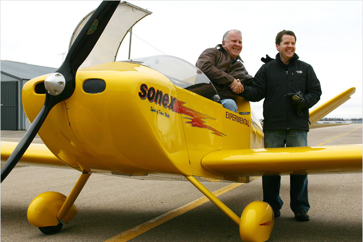
Build Partners Phil Simon and Jerry Bassler of San Rafael, California first flew Sonex# 492 in February 2006, and have since flown many long cross countries in the aircraft. On July 21, 2008 the aircraft touched-down in Maryland, completing Simon’s goal of landing their AeroVee-powered Sonex in all of the lower-48 United States!
“Our Sonex is the perfect airplane,” writes Phil Simon. “Lots of fun to do basic aerobatics in (loops & rolls) and enjoyable to fly cross country in. The little AeroVee engine is bullet proof… Building the Sonex & the AeroVee were two of the most rewarding things I have ever done.”
Trip Stages:
- August, 2006: 10 States
- September-October, 2007: 32 States
- July, 2008: The Last 12 of all Lower-48 United States
September-October, 2007 – 32 States
- Phil’s excellent Sonex Adventure
I just returned after more than 6,400 miles of flying over 12 days in my Sonex. I landed in 32 states and had a great adventure. This flight was a shake down for the Alaska Highway flight I am planning for summer 2008. It confirmed for me what I already knew – that the Sonex is a great airplane. It does just fine on cross country flights, is fun to fly around the pattern and exciting to do aerobatics in. I do have a DigiTrak wing Leveler in my Sonex and it really makes longer flights easy.
My route of flight was roughly a CW circle from the San Francisco area of California to Oregon, Washington, Idaho, Montana, North Dakota, South Dakota, Minnesota, Iowa, Nebraska, Kansas, Missouri, Illinois, Indiana, Ohio, West Virginia, Virginia, Kentucky, Tennessee, North Carolina, South Carolina, Georgia, Florida, Alabama, Mississippi, Louisiana, Arkansas, Texas, Oklahoma, New Mexico, Arizona and Nevada.
I flew professionally for 32 years, but this flight was more fun and had more excitement than any of my flights in larger aircraft. I feel very fortunate to be able to have flown this trip.
I had lots of weather; 50 mph headwinds; unbelievably strong cross winds on landing; cracked my canopy in North Dakota; patched it in Missouri (thanks to Gus Schlegel); got the sheriff in West Union, Ohio, to drive me to a motel when there was no other transportation; had the plane polished by two women in Athens, Tennessee; spent two great days in Crossville, Tennessee, at the American Sonex Association Fly-In; had a flat tire there (thanks to John Davis for helping me out with a new tube); took spin training in Sewanee, Tenn., and did a 23 turn spin; climbed all over a USAF KC-135 tanker in Georgia; had a dead battery in Macon, Georgia; waited out the passing of a cold front in Monroeville, Alabama, along with several Navy T-34Cs; made a quick precautionary stop in Ardmore, Oklahoma, when my oil pressure dropped; made a quick decision to stop in Amarillo, Texas, when thunderstorms appeared and barely got my plane in their hanger when the hail hit; learned about keeping my engine running on the ground at high altitude airports at Double Eagle, New Mexico; flew through the smoke from several forest fires near Flagstaff, Arizona; discovered Bullhead City, Arizona and all the casinos across the river in Laughlin, Nevada; flew over the Cajon Pass into the LA basin under the clouds and above the highway and found a helicopter in my path; etc. etc. What an adventure!
Tomorrow I will post more details about the flight.
Phil Simon, Sonex 492
- Phil’s excellent Sonex Adventure: Part 1
Here is part one of the details of my 6,400 mile, 12 day flight in my Sonex. I landed in 32 states and had one of the greatest adventures of my life. The excuse for the flight was to attend the American Sonex Association’s 4th Annual Fly In at Crossville, Tennessee, and the flight was the final shakedown or my planned flight up the Alaska Highway next summer.
Day One: I left San Rafael Airport (CA35, pvt.) and landed at Redding (RDD) for my first fuel stop. The excitement began shortly after I took off and was flying over Shasta Lake when the red warning light for my Grand Rapids EIS came on. I noted my oil pressure numbers flashing and made a quick 180 degree turn and headed back to dry land and the nearest airport. My
adrenaline was really flowing when I saw the numbers going from 50 to 10 to 0; then I realized I was looking at the vertical speed numbers on the EIS. The display had flashed from the warning page to another after I acknowledged the warning. What a relief and embarrassment that was. I sheepishly turned back and continued on my way. As an aside – I was plagued by that low oil pressure warning light for the next few days until I called Grand Rapids and they told me that In addition to minimum and maximum values there is a THIRD oil pressure value, the “cruise oil pressure”, that I should check. Sure enough, the value was set at 32 psi and my AeroVee usually runs 30-31 psi once I throttle back to cruise RPM. Once I reduced that setting in the EIS there were no more false oil pressure warnings.After flying by the Trinity Alps and Mt Shasta I crossed into Oregon and landed at Klamath Falls (LMT) for fuel. There were nonstop military fighters doing touch and goes there and I was glad to depart without any wake turbulence incidents. Next fuel stop was Madras City-County airport (S33). I then turned northeast in order to avoid the large restricted area around the Hanford Nuclear Facility. I then crossed the Columbia River into Washington and flew on to the TriCities area where I landed at Kennewick’s Vista Field (S98) for the night. The airport had a courtesy car and the motel was nearby. Day Two: Early the second day I was off, flying past the irrigated farm lands in southeast Washington to the rising terrain and pine trees south of Spokane. Continuing I made the first fuel stop at Coeur D’Alene, Idaho (COE). It was cold there and I flew the next few legs wearing a fleece vest. I followed interstate 90 (94 after Billings) across the Rockies. This part of Idaho is beautiful with homes crowded into narrow valleys. Leaving the panhandle of Idaho I flew into Montana. The highest spot on this route was Mullan Pass (5,168′) which has its own ASOS. It is certainly easier to cross the mountains on this route (the highest I got was 7,500′) rather than the I way flew last summer coming home from Oshkosh. Then I followed Interstate 80, flying over Utah and Wyoming where the airports are over 7,000′ and the summer density altitudes were really high.
My next fuel stop was Missoula, Montana (MSO).I next flew by Anaconda and its giant copper mine and facilities. Then past Butte and Bozeman and through the Bozeman Pass where a RV (which I never saw) was going the opposite direction 1,000′ below me. I landed at Big Timber (6S0) for fuel, but there was no one at the airport (I then learned to look for self serve fuel in
my Flight Guide), so back up in the air to Columbus, Montana (6S3) for the night. The Montana Dept. of Aviation had provided two courtesy cars here, so I was off to a motel and dinner. Columbus is pretty small (pop. 1,748) and the eating choices I found were limited to two casinos. But it was a good meal at a low price – a pilot’s dream come true.Day Three: I had planned on leaving Interstate 90 at Columbus and flying directly to Bridger, Wyoming (I would then have landed in 33 states) as it was only a 50 mile detour, but I was being chased by a cold front all the way across Idaho and Montana and it was catching me. So the next morning I was off right at dawn. As the sun was rising I watched my Dynon EFIS send me the message “Sunrise” and then “Switching to daylight mode” and right before my eyes it reversed from a dark screen with light data to the opposite. How does it know? I flew right over the Billings Airport at a low altitude as they had no traffic, and the tower wanted to know all about my plane. (This happened at several airports.)
Once I was over Miles City (Wiley Field, MLS) I left the security of Interstate 94 and flew due east over eastern Montana to southwest North Dakota and landed at Bowman (BPP). Their AWOS cautioned about high winds and I made the first of what was to be two days of unbelievable crosswind landings. Fortunately the Sonex handled them all very well, but it is a bit disconcerting to be lined up with the centerline and looking at the runway off to the side, just in front of the windshield bow. After fueling I flew along the N.D./S.D. border as far as McLaughlin (5P2) where I turned southeast and those crosswinds became headwinds. My ground speed dropped to 50 mph, so I was bucking 50 mph headwinds. I crossed the Missouri River at Mobridge (MBG – Missouri Bridge) and struggled with the headwinds for another 40 miles. I tried various altitudes without any success and watched as my GPS generated ETA kept getting longer and longer. I finally gave up and landed at Gettysburg (0D8) South Dakota. I landed again with a big crosswind and found it difficult to taxi with out weathervaneing. I parked head to the wind, but as soon as I opened the canopy the 40 mph winds ripped it out of my hands and slammed it open – resulting in a 6 inch crack in the back right side and both bows distorted. It
was now very difficult to open or close the canopy latch. Arghh! I gave up for the day and retreated to the 7 unit Trail Motel (which had been purchased for $ 35,000 over the internet by a couple from California). I was their only customer and they were hoping for more business once Pheasant season opened. Gettysburg is pretty small (pop. 1,352) and the only market “chose not to sell beer”, so I had to settle for diet Pepsi.Day Four: The next morning I stop drilled the crack and made a temporary repair by using small nuts, bolts and washers to hold the two sides of the crack together. I took off into the same winds, but as I was now heading for Minnesota they had more of a crosswind component. My ground speed was better, but the ride was awful. We were slammed up and down, right and left. I was glad to stop for gas at Madison (MDS) S.D. where the self serve gas had been out of business for two years (good job Flight Guide) but fortunately the FBO manager drove up and fueled me from his truck. Then I was off on a rough 50 mile flight to Aanenson (LYV), Minnesota. Another crosswind landing and I took photos of the airport and launched. I was hoping to get to Kansas City to visit Gus Schlegel, but the ride was extremely rough and as I was now going south the 50 mph headwinds were back. I finally gave up and landed at Cherokee (CKP), Iowa. I think it was the most difficult landing I have made in 17,000 hours of flying. The winds were gusting, I was bouncing all over the sky and having to deal with another strong crosswind. The gusts would suddenly stop and we would drop; it wasn’t pretty, but I did safely get my Sonex on the runway. I really tied it down securely and installed my gust locks. Things must be peaceful in Iowa – there were no gates on the 3 foot high security fence and the very nice pilot center was unlocked. It was the weekend and no one was there. I called the number on the wall and the airport Mgr. told me to take one of the sets of keys off the hook on the wall and take one of the 4 courtesy cars parked outside! They were all old Iowa State Trooper cars, but it was great to be able to drive around. I was safely on the ground, had a good dinner and got the senior discount rate ($4.00) at the local movie theater (saw the 3:10 to Yuma). Life is good!
Day Five: The next morning it was raining cats and dogs with thunder and lightening. I figured I was going to be in Cherokee for a while, but I called Sonex owner John Davis (of Crossville, Tenn., who organized and put on the entire American Sonex Association Fly-in). It turns out that John has a complete weather station at his house with live radar returns, etc. etc. He had very nicely offered to give me weather info during my flight and had loaded my route into his flight planning program. I called him several times for advice and it was always good. He told me that it was a fast moving front and I should be able to take off just after noon. The front curved to the southwest and as I was flying south I would have to be careful not to catch up with it. True to his prediction I was able to take off around noon and head south behind the front. It was a much better ride now and I landed in southeast Nebraska at Brenner airport (FNB) just as the last showers were passing through. I fueled up and then watched the radar coverage on their computer until the front was just about past Lawrence, Kansas (LWC), my next stop. It was a short flight there and I landed in good weather and took photos and took off for the short flight to Kansas City. Unfortunately, I took off from Lawrence 5 minutes too early and ran into the back of the front and had to put down at Oalthe Johnson Co Executive (OJC) airport and wait 5 minutes for the weather to get past Lee’s Summit (LXT) where Gus was waiting for me. I called him on the cell phone and he said it the front had just passed so I took off for the short flight to Missouri. Gus Schlegel belongs to a great EAA Chapter. They own two large hangars with about 6 member’s planes or projects in each, and are building a third hangar. Gus put my Sonex into his hangar (it would hold 20 Sonex) and he then took me out for the best BBQ rib dinner I have every had and put me up for the night. What a great friend Gus is – thanks again.
Day Six: The next morning Gus insisted on making a proper repair to the cracks in my canopy with aluminum strips and some softer, wide headed aluminum rivets (available from Sonex) to hold everything together until I could get home. He also removed all the screws holding the canopy to the hoops (leaving the sides still attached) and pulled the hoops forward away from the canopy, bent them back into shape. He is a real craftsman and it was a pleasure to watch him work. It was noon time before the repair work was complete. He launched his beautiful 3300 powered Sonex shortly after I did and quickly caught me flying east. After a little formation flying he pushed in his throttle, surged ahead and pulled up into a wingover in front of me. He returned to Lee’s Summit and I continued on to Mexico Memorial airport(MYJ) and fuel. This is the home of Zenith aircraft and I got some photos of their twin engine Gemini CH620 that is still in the testing stages. Continuing east I steered clear of the St. Louis class B airspace and crossed the Mississippi River. I landed at Effingham Co. Mem’l (1H2), Illinois, took photos and took off for Indiana. This was a great day as I had a 30 mph tailwinds all day. Climbing to try to get better winds I ran into scattered clouds just below me. They rapidly turned into a broken ceiling, forcing me to dive through a hole to keep from getting caught on top of an overcast.
I learned a lot over Indiana – the Princeton Fuel Probe for my Grand Rapids EIS was calibrated carefully, but I had never flown long enough to check its accuracy at the lower levels (I usually stop every two hours, stretch, pee and buy 8 gallons of gas). As I was approaching my intended Indiana destination I checked my fuel level and it read ZERO. Once again the adrenaline flowed and I quickly pushed the “Nearest Airport” button on my Garmin GPS. It turned out to be my intended destination, Grissom (BFR) field, so I made a gliding descent and landed on the closest runway. It turned out I still had 3 gallons of gas (which is what I had figured) and I now know my fuel level readings are not very accurate at the lower levels. I also learned how valuable the “Nearest Airport” button is!
Taking off I flew under the southern portion of the Cincinnati Class B airspace and continued east. I had hoped to make it to Huntington, West Virginia, today, but due to my not taking off until noon time, I determined that I was going to be short about 20 minutes of daylight. My Sonex is equipped for night flying with strobes, position lights, landing light, cockpit lighting, etc. But I am now flying as a Sport Pilot (day, VFR only) and didn’t really want to be flying over the hills and trees of western Kentucky at night. So I made a decision (it turned out to be the wrong decision) to land in Ohio. I turned northeast and landed at Salamon West Union airport (AMT). I landed just at dusk. There was nothing there! The only building was locked up and the airport was 13 miles from town. There were no taxis and the local tow truck driver was tied up. I finally got the county ParaMedics to pick me up and drive me into West Union for the night. Life would have been a lot easier if I had continued to Huntington W.V., as it took a long time to get the ride that evening and over a hour and a half the next morning. I’m not complaining as I appreciated the rides, and besides, the county Sheriff who gave me the ride in the morning told me all the gruesome details about the man who, the day before, had shot his neighbor and then shot himself in the head right in front of the Sheriff. You don’t want to know the details!
To be continued
- Phil’s excellent Sonex Adventure: Part 2
Several builders have asked me about my Sonex – I built it with a partner, Jerry Bassler. We each own half and it has been a great arrangement. The plane is Sonex 492 and the first flight was Feb. 2006. We have almost 200 hours on it. The plane is a trigear, dual stick (I remove the passenger stick for flights like this) and AeroVee powered. The engine is bulletproof. We did have overheating problems (high CHTs) in 2006, but installed the new air baffle system and that problem went away. We are now trying to locate a pesky oil leak, but that too will be overcome. The plane is heavy with a lot of extra things that I might not install again. However, I’m very glad to have a good radio (Becker), the wing leveler (Digitrak), the Dynon EFIS and the Garmin GPS. If I hold the wings very level while the gyro on the wing leveler is erecting, the plane will fly straight and true for 20 minutes or more. When the wings are level the pitch becomes very stable and all I need to do is lightly press on the stick to maintain altitude. This was very helpful when folding and unfolding all the charts I brought along.
Day Seven: Leaving West Union, Ohio, first thing the next morning it was a short flight to the Tri State Ferguson airport (HTS) at Huntington, West Virginia It took a while to get fuel as the fuelers are also the airport firemen and an aircraft with a mechanical problem came in just as they were getting ready to fuel me. The airport sirens came on and they dropped everything and ran to the firehouse. After getting fuel I then flew south over the hilly West Virginia Appalachian area and the eastern tip of Kentucky. I like to fly as much of the journey as I can at 1,000′ AGL, but this area was so rugged that I climbed to 4,500′ to have some room to glide should I need it. Since I was concerned about the terrain and no place to land I used Flight Following and they gave me a hard altitude and heading. I put on the wing leveler and flew the entire trip without busting my heading or altitude (I love my wing leveler) even though I was taking photos, digging out charts and looking up airport information in my Flight Guide.
I flew to the western tip of Virginia and the Lonesome Pine (LNP) airport. This was a beautiful area and a very nice airport. After fueling I left and overheard some pilots on the ground talking on the radio. One asked the other what kind of airplane I was and then commented what a loud engine I had (I have an AeroVee without mufflers, and it sounds great; not at all like the lawnmower sound the two cycle engines have). I now headed for Middlesboro Bell Co (1A6) airport in the southeast corner of Kentucky. I wanted to go there because that is where they rebuilt Glacier Girl, the P-38 that was dug out of the ice in Greenland. Unfortunately it was no longer there as (so the locals told me) it had been sold for 10 million dollars . I was fascinated by the Middlesboro airport – I couldn’t find it. My GPS said it was a few miles away but no airport in sight; then I realized it was just over some hills in front of me and in a bowl, surrounded by hills on all sides. I cleared the hills, pulled off the power and dove for the runway. Quite an experience (later on to be duplicated in El Dorado, Arkansas). Gas was fairly cheap there at $4.04/gallon. I then took off and circled for altitude to clear all the hills and headed for Tennessee. My first stop was McMinn Co (MMI) airport at Athens. The Swift Foundation’s Museum is there. Swifts were beautiful little (although twice the size of a Sonex) aircraft made by the Globe Aircraft Company in Dallas after W.W.II. They even made a military version with tandem seating, canopy, .30 cal machine guns in the wings and three rocket under each wing. It was called the T-35 and was not selected as a trainer as it was not tricycle gear as the T-34 was. At any rate all of the museum’s aircraft are beautifully polished and the work was done by two women. When I heard that John Davis had arranged for them to give a polishing demo at the ASA Fly-In I immediately volunteered my plane, but they informed me that it would take longer to bring out my shine than they were going to have at the demo in Crossville. So I contracted for them to work on my plane for two days and bring out a better polished finish than I had done. They did a beautiful job at a bargain price. It turns out that the the Swift Museum has almost 40 years experience polishing airplanes and has tried every product and polisher on the market. They came to the conclusion that the Nuvite products were the best. I learned a lot the two days I spent there. I had been trying to get a polish on my plane using a buffing pad the whole time. I learned that I should have been using a coarser compounding pad for the F-9, then switching to the buffing pad for the less course grades.
I cleaned up the plane and changed my oil while I was there. I also met Tony Forres, saw his beautiful Sonex and met his wonderful family. We then flew together to Crossville, Tennessee, (home of Trade-a-Plane) and the 4th annual American Sonex Association Fly-In. My thanks to John Davis for putting on an outstanding gathering. It was well organized, there were good demos and presentations and all the food was great. There were almost 80 Sonex builders and enthusiasts there. I gave four demo rides the first day, but unfortunately the next morning I had a flat tire. John bailed me out of trouble by providing a creeper, blocks of wood, jack and spare tube. I learned that on my next trip I must bring along a couple of spare tubes and also a can of air and Goo (?) leak sealant.
The next day I flew a short distance to Sewanee Franklin Co airport (UOS), Tennessee, where Catherine Cavagnaro (Ph.D. mathematics professor) teaches spins. She owns the Sewanee Aerobatic School (http://www.aceaerobaticschool.com). She is the protégé of the late Bill Kershner and since his passing is now the premiere Spin Instructor in America. BTW, there is a U-Tube video of her spinning her Cessna 152 Aerobat 60 times! (see http://www.youtube.com/watch?v=iQkk0JLjEJY). I took an all day class on spins and aerobatics with her and finished off the day with a 23 turn spin! Wow! It was money well spent as I had never done more than two turns in a spin and was always uneasy while doing them. I can now recover in about 700 feet, but that is not enough altitude if you do a stall spin while in the traffic pattern. We did several of those (at altitude) and there is NO chance of recovering before you hit the ground if you ever get in that situation. Make a go around instead!
Day Eight: Another beautiful day and the start of my return home. I took off from Sewaneee and headed east past Chattanooga to the Andrews-Murphy (RHP) airport located in the western tip of North Carolina. A very pretty, but hilly area. Once I left Tennessee it was wilderness below and I kept near the roads. After fueling I flew south to South Carolina and landed at the Andrews Regional airport (AND). Tractors were plowing fields on the airport and the red dust was billowing up everywhere. More fuel and I was off for the last leg of the day. Crossing the Savannah River and flying over the woods of Georgia. I flew south, passing east of Atlanta, and continuing to Macon and landed at the Middle Georgia Regional Airport (MCN). It is just a few miles from the Warner Robins USAF base, where a friend of mine, Capt. Jamil Bjorkland, is based. After showing him my plane (and forgetting to shut off my master switch) we went to the base and he showed me all around and let me climb through his KC-135 tanker. These are 45 year old B-707s but re-engined with CFM-56 engines which are great engines. Jamil had spent 11 hours the previous night smoking and making pulled pork. We had great pulled pork sandwiches (complete with cold slaw and a pickle on top) for dinner and the next day he sent me off with three more which I kept in my cooler.
Day Nine: Arriving at the airport I found my battery dead (my fault forgetting to shut off the master switch). Realizing that the trickle charger I carried with me wasn’t going to do the job, I located a regular battery charger and an hour later was ready to go. I flew straight to the panhandle of Florida and the Crestview Sikes airport (CEW) which is located between two of the Pensacola restricted areas. I used Flight Following radar on the way there, as I cut through Alert Area A211 and didn’t want 23 year old USN ensigns in their T-34s jumping me. The FBO there tried to round up the fuel bill saying that they always rounded up and charged for full gallons, not fractions of gallons. I was successful in my protests and even walked away with some free popcorn, though I could feel the woman behind the counter glaring at my back. I then flew north and then cut the corner of another Alert Area in Alabama where I was promptly jumped by one of the new Navy turboprop T-6A Texan trainers. I peeled off as he dove at me, and I guess his instructor must have intervened as they left me alone.
I knew I was heading towards another approaching frontal system and after dodging some showers decided that it was time to land and let the weather pass. I made a quick pattern into Monroeville, Alabama’s, Monroe Co (MVC) airport. There were showers on the downwind leg and another just off to the side of the approach end of the runway. I had to make a very close in, tight pattern and all I could think of was the stall-spin situations of two days before. Once on the ground I found several USN T-34Cs, the turboprop version of the old T-34, there. They were also avoiding the front with the added benefit that the FBO gave them free lunch if they purchased more than $ 50 worth of fuel. Since I only burn 4 GPH I didn’t qualify. The FBO had a great internet hook up to weather radar and I could watch the front move in and when it looked OK I took off again. I flew west across Mississippi and landed at Vicksburg (VKS) right on the eastern shore of the Mississippi river. The old building that was the terminal looked like it was right out of New Orleans. Painted red with white cast-iron gingerbread trim all over. I took some photos, encouraged the teenage fuel boy to stick with his dream of becoming a pilot, then took off for a quick 10 mile flight to the larger Vicksburg Tallulah Regional airport (TVR) located across the river in Louisiana. I fueled up and started bucking the headwinds as I flew to Arkansas. Due to losing a couple of hours waiting for the weather, I calculated that I would not make it to Texarkana before dark and it didn’t look smart to fly over the Arkansas woods at night. I elected to land at the El Dorado Downtown airport (F43) rather than at the larger South Arkansas Regional/Goodwin (ELD) airport which was quite a few miles out of town. Downtown airport was walking distance to town and after my experience in West Union I decided to go there. There were really tall trees at the approach end, and a short runway, so once again I pulled off the power and dove to the runway. It worked out well and I was lucky to get a ride into town with the pilot of another plane that was based there. He told me they were hoping for some money from the FAA so they could cut down the trees which were right up to the runway, effectively making it quite a bit shorter.
Day Ten: The next morning I took off at sunrise and headed into the corner of Texas, landing at Cox Field (PRX) outside Paris, Texas. After fueling I flew across the Red River into Oklahoma. I had been dealing with a slow oil leak (which seemed to be increasing) for most of the journey and was having to add oil regularly. Each stop I checked the oil level but was having trouble accurately reading the dipstick. I had to read the dipstick multiple times each occasion and was still not positive of my oil level. Jerry had previously tried to solve this problem by replacing the stock AeroVee oil dipstick by silver soldering on the end of an automotive oil dipstick which has cross hatching marked on one face. It was still difficult to read, especially with new clean oil.
After taking off from Paris I noted the oil pressure was running at 24 PSI instead of the normal 30-31 PSI. After less than an hour the pressure started falling rapidly, I could see the Ardmore (ADM), Oklahoma, airport and quickly contacted them, told them about my oil pressure situation and asked for an expedited landing. When I pulled off the power the oil pressure dropped and my nemesis, the EIS red warning light came on again, this time for real. Once on the ground I added a quart of oil, but still couldn’t determine the oil level accurately. After talking with Jerry by cellphone he recommended draining out the oil and starting over with 2 3/4 quarts of new oil. The FBO kindly let me use their hanger and even provided a creeper. I removed the cowling and drained out the oil. All two quarts of it! Since I had just added a quart, I must have been flying around with only one quart of oil instead of the recommended 2 3/4 quarts. Arghh! Then and there I resolved to cut another hole in the top of my cowling so that the oil drip stick could be more easily removed without scrapping it on the sides of the tube or the lip of the cowling inlet. Also this would allow another type of drip stick (wood?) to used if necessary. I purchased 7 quarts of oil from the FBO, and after adding the full 2 3/4 quarts, put the rest of the oil in the cockpit with my tool kit, cleaned up and took off again. The entire event took almost 4 hours! From then on I really watched my oil consumption and oil added, and repeatedly checked the dip stick until I could be sure of the actual level.
Leaving Ardmore I headed northwest, passing just southwest of Oklahoma City and soon hooked up with Interstate 40 which I intended to follow all the way to southern California. I always flew airport to airport using my GPS, as I don’t have a VOR receiver (nor do I need one). It was a lot more comfortable when these airports are near the interstate instead of flying across some rough terrain to get to the next one. I landed at Elk City Regional airport (ELK) for fuel (the cheapest of anywhere at $3.59/gallon) and continued west. Soon I was in Texas again, flying across the panhandle. I was going for Tucumcari, New Mexico, but ran into several thunderstorms as I was flying under the south side of the Amarillo Class C airspace. I made a quick decision to land at Tradewind (TDW) airport located on the southwest side of the city, and flew a close in pattern to beat the weather. I barely got the Sonex into their hangar when the hail started falling. The motel provided free transportation and was located only two miles away. I knew I was in Texas when there was a large sign in the lobby offering a 72 oz. (gasp, 4 1/2 lbs!) steak for free if you could eat the steak and the entire meal within one hour. I passed on that offer.
Day Eleven: Today was a huge day as I flew 8 hours and 25 minutes trying to get back on schedule after the previous day’s excitement. I left Amarillo right at sunrise and soon entered New Mexico. There are no airports with fuel anywhere between Amarillo and Tucumcari, so I made sure I was fueled before I took off. The terrain starts getting higher here and Tucumcari is at 4,065′. A quick pit stop and I was off, still following I40. I flew over Santa Rosa Route 66 (I58) airport where I had planned on stopping to look around, but didn’t to save a little time. Then past Moriarty Airport ((0E0) and on to the Albuquerque area where I flew through the same pass in the Sandia (watermelon) Mountains that the interstate uses. I love the terrain feature of my Garmin GPS,; it is much more detailed than the Sectional charts and I am able to determine the best route in advance of getting to the mountains. I had to be low to keep under Albuquerque’s Class C airspace so they couldn’t get me on radio or radar until I popped out of the pass on the west side just a few miles short of the city, the Int’l airport and the TFR for the big hot air balloon event which was in full swing. A quick radio call to the tower and they gave me vectors through their airspace, avoiding the hot air balloon TFR and headed towards Double Eagle II (AEG) airport on the west side of Albuquerque.
Double Eagle is quite an airport. Lots of traffic and noise. Just after I landed a B-25 and a P-47 flying formation made a low pass over the runway then returned for a landing. There were Army Blackhawk helicopters making landings, and the ramp was full of some type of small VLJs (Epics, I think). They were doing their flight training there (they had a L-39 trainer there which they used for upset training) and sat in their planes with the noisy engines running while they spent long periods getting the cockpit set up. I assume they don’t have simulators or Procedures Trainers for these VLJs and have to do all the training in the planes (making unbelievable noise while I was trying to carefully determine my oil level). Even though I had arrived first, the line boys brought their fuel trucks to the B-25, which took forever to get filled. Eventually they came over and gave me all of 10.5 gallons. I was glad to leave the noise of the ramp and be underway. BTW, the airport is at 5,837′ and I did have some difficulty taxiing in after landing, killing then flooding the engine. Eventually I found the correct mixture setting and taxied in. The interstate makes a big loop to the south here and I started to fly directly to the next airport, but thought the better of it and, tail between my legs, returned to the comfort of following the Interstate. I flew past Grants, then Gallup, the location of radio station KNDN (Indian) voice of the Navajo Nation,where they play country and western music and all the advertisements are in the Navajo language. If you have never heard it spoken you have missed something. It is absolutely unintelligible to me and I can see why they were used as radio talkers in W.W.II. Just prior to Gallop I passed just to the north of the restricted area at Fort Wingate. According to Google, Fort Wingate is a semi-active military site that occasionally shoots missiles to White Sands Missile Range, 150 miles south. It looked pretty active with some large office buildings and hundreds of bunkers. It looked like there were some supporting contractor’s facilities in the surrounding area. I took photos of it all and suppose the CIA will be contacting me shortly. After Gallup I entered Arizona, and flew over the Petrified Forest National Monument but couldn’t see anything interesting from 1,000′ AGL.. I stopped for fuel at Winslow-Lindbergh Regional (INW) airport ( according to the line boy, once owned by Charles Lindbergh and used as a landing site by Transcontinental Airlines in the 20’s and 30’s). Looking to the west I could see the smoke of a large forest fire and hoped that I wouldn’t have to fly thought it (I did).
I took off for the fourth and final leg of today and headed towards Flagstaff (FLG) which is at 7,014′. My little Sonex was loaded to the gills for this flight and I really struggled to get enough altitude in the hot afternoon air. I departed California with 17 lbs. of tools; spare parts; a 13 lb. survival gear kit and two gallons of emergency water (total weight for survival gear was 30 lbs..); 20 lbs.. of personal gear (including my leather flight jacket); 17 lbs.. of Flight Guides (all 3 volumes) and charts (next time I’m leaving most of the charts behind, I never used the WAC charts and half of the others. Only the Sectionals and Terminal Area Charts were useful); 5 lbs. of towbar, tiedown equipment, and handheld VHF transceiver; plus along the way I had added things. I will have to really rethink things for the Alaska Highway trip as it will require also bringing along extra fuel.
I flew through the smoke of the large fire just before Flagstaff, and then through the smoke of at least three other smaller ones in the forests to the west of Flagstaff. Pressing on I passed Kingman, Arizona, and approached my destination of Laughlin/ Bullhead Int’l airport (IFP) from the east. The VFR arrival from this direction calls for flying over Union Pass at 6,000′ and then flying over the airport, only 6 miles away, at 2,200′. I dove and roared past a Cessna 172 that was plodding along on the same route. The traffic pattern is to the west of the airport, downwind leg over the casinos on the Nevada side, then base leg over the Colorado River just downstream of Davis Dam and then landing to the south in Arizona. I had never been to this area before and was amazed by it. The airport and all the 40,000 residents live on the Arizona side while the 11 casinos are all on the Nevada side. It looked like all 40,000 live in house trailers, as there were hundreds of them south of the airport. This is a great destination for a cheap pilot. The casinos are only two miles from the airport. I stayed at the Riverside, which provided free transportation to and from the airport, a beautiful large room was $ 32, and they had 7 restaurants including an “all-you-can-eat” buffet. What pilot could ask for more?
Day Twelve: Today was going to be my last day and I planned on flying all the way back to the San Francisco area. But the weather didn’t cooperate and I ended up instead at the Torrance airport in Southern California. I took off at dawn and flew across the Colorado River to Nevada and the short 30 mile flight to the nearest airport with a paved runway at Searchlight, Nevada (1L3). It is an uphill landing (watch the power lines on short final) and a downhill takeoff. The airport is next to Highway 95 and there is NOTHING there. Just a 50 gallon drum for trash and a sign proclaiming that an airport community would be built there shortly. Searchlight has a population of 780 and is located southeast of Las Vegas and west of Lake Mojave on the Colorado River. I don’t think an airport community will be built there anytime soon. However, just 8 miles south I flew over an airport community that we can all afford to live in. It is Kidwell airport (1L4) with a 4,140′ dirt strip. Every house I could see was a house trailer and it appears that they all have hangars. The population is 400 and there is a casino (with penny slots), motel (10 units), RV park and convenience market. Not only could I afford to have my dream airport house (trailer) and hangar there, but the entire place is for sale. Taking off downhill and right next to the highway, the temptation to stay really low and flash by the trucks was too strong to resist; but I did have to zoom over the power lines. I flew 1,000′ AGL all the way to the Barstow-Daggett airport (DAG) in California. This was a fascinating airport with lots of old W.W.II wooden hangars built by Douglas Aircraft to house the A-20s they were converting to give to Russia in the 1940’s. Currently there is a large military helicopter maintenance facility there. Recently the gov’t. contracted for a large folding hangar door to be installed on one of these old (65+ years) wooden hangars. It was, and within days the entire hangar collapsed from the weight. The pile of shredded wood is still there. My next leg was to be westward, passing just south of the Edwards AFB restricted area; then to the Mojave airport (MHV) to look at all the parked airliners and to see Scaled Composites; then over the Techachapi Pass to the San Joaquin Valley and home. But a call home alerted me to the fact that for the first time since I had left over two weeks ago, it was raining heavily all day long. So I changed my plans and decided to fly into the Los Angeles basin to visit my uncle who is a pilot and has completed a homebuilt.I took off and flew by Apple Valley (APV) and Hesperia (L26) climbing to get enough altitude to clear the Cajon Pass. There was a layer of clouds obscuring the highest mountain tops on either side of the pass so I flew under them following the highway. There was a helicopter flying the same route and I had to pass him, all the time referring to the Terrain page on the Garmin GPS (love that feature). Just as I popped out on the south side of the pass, and was approaching a sea of Class B, C and D airspaces, my noise canceling headset chose to die. I opted to make a quick landing at the old Norton AFB, now the San Bernardino Int’l airport (SBD), to install new batteries, collect myself after the flight through the pass, and to brace myself for flying through the LA basin and all its restrictions. There used to be an old 747 parked at this airport (I didn’t see it this visit, but suspect it is still there as it is unflyable). It had been operated by the CIA during the Viet Nam era and the name “Southern Air Transport” is still on the side. It was parked at the Air Force Base after the war to keep it out of view of the public, but now the airport is civilian and everyone walks around this beast with all its flat tires and radio gear filling the cabin.
I took off and wound around avoiding the Riverside March Field, Ontario, and Santa Ana Class C airspaces (I couldn’t fly over them due to the clouds). I either flew over or avoided the Class D airspaces of Riverside, Chino, Fullerton, Los Alamitos and Long Beach airports; all the while staying under the Los Angeles Class B airspace. Arghh! When I finally got near Torrance Zamperini airport (TOA) they had me do 360s until they found me and finally let me land. I much prefer following the highway over Tennessee than all these restrictions. Torrance airport is very interesting as it is the home of the largest general aviation aircraft manufacturer in the U.S. – Robinson Helicopters. The airport is filled with these small helicopters, and there is lots of helicopter flight training going on. I had a great visit with my relatives who treated me like royalty.
The next day I waited until there was a hole over the airport large enough to climb out to 4,500′, the required altitude for flying the “Los Angeles Special Flight Rules Area” route to the northwest. This route goes from the Torrance airport, directly over the center of LAX, to the Santa Monica airport (SMO). All this without the need to get an air traffic control authorization. I was glad to fly over the Tejon Pass and leave the LA basin behind. It was all downhill from there. The lower portion of the San Joaquin Valley was socked in, but I had waited until it was starting to break up and there were plenty of holes to fly through should the need arise (I don’t fly over a solid undercast in a single engine airplane). One stop for fuel at the Harris airport (3O8), home of the Harris Beef Ranch and the best $30 steak you will ever have. (I didn’t). You can smell the perfume from the feed lot miles away. Watch a video about flying to here at: http://s9.video2.blip.tv/0920000001640/Schlomo-HeyLetsGoToHarrisRanch855.mov
The final leg was home and an end to a great adventure.
I’ll post the numbers (fuel burn, etc.) as soon as I have time to gather the information.
- Phil’s excellent Sonex Adventure: The Numbers
Here are the numbers from my recent long flight:
Distance covered: over 6,700 sm. Difficult to get exactly as I followed highways a lot.
Total Flight Time: 67:35
Avg. Speed: just over 100 MPH (could have been higher but I throttled back to an average
of 3,000 RPM for fuel economy)Avg. Fuel consumption: 4.3 GPH, and I was flying pretty much at max. gross weight.
States landed in: 32. California, Oregon, Washington, Idaho, Montana, North Dakota, South Dakota, Minnesota, Iowa, Nebraska, Kansas, Missouri, Illinois, Indiana, Ohio, West Virginia, Virginia, Kentucky, Tennessee, North Carolina, South Carolina, Georgia, Florida, Alabama, Mississippi, Louisiana, Arkansas, Texas, Oklahoma, New Mexico, Arizona and Nevada.
Most states landed in one day: 5 states on Oct. 09, 2007, started in Georgia, landed in Florida, Alabama, Mississippi, Louisiana, Arkansas
FUEL
Total Fuel Burned: 292.5 gals
Avg. Fuel Consumption: 4.3 GPH
Total Fuel Cost: $ 1,438.22
Average cost/gallon: $ 4.92/ gallon
Most expensive gas: Coer D’Alene (COE), Idaho $ 5.69/ gal
Second expensive gas: Macon, Georgia $ 5.19/ gal
Cheapest gas: Elk City (ELK) Oklahoma $ 3.59/ gal
Second Cheapest Gas: Tallulah Vicksburg, Louisiana $ 3.70/ galFBOs
Best supplied (snacks, food) FBO: Daggett Aviat., Barstow Daggett (DAG) California
Second best supplied FBO: Anderson Regional (AND) South Carolina
Most helpful FBO: Ardmore (ADM), Okla. Let me use hangar, creeper, assisted me, etc.
Second best FBO: Gettysburg, SD Let me use hangar, ass’t in patching canopy
Third best FBO: Lowe Aviat. Macon, GA. Let me use battery charger for free
Worst FBO: Sunshine Aero Indus., Sikes Airport (CEW), Crestview, Florida. Insisted that they ALWAYS round up the total gallons sold to the next higher amount.Airports providing courtesy cars:
Vista, WA
Columbus, Mont.
Cherokee, Iowa
Sewanne, Tenn.MOTELS
Cheapest good motel: $ 32 Riverside Casino,Laughlin Nev. (with free transportation)
Cheapest bad motel: $ 30.99, Budget Host Inn, Monteagle (Sewhanne), Tenn.
Best Motel Breakfast: Days Inn-East, Amarillo, Texas (biscuits & gravy, fresh waffles, scrambled eggs, tortillas, English Muffins, muffins, fruit, juices, etc.)